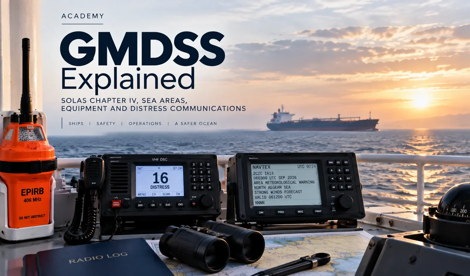
GMDSS is the communications safety net behind modern merchant shipping. It combines terrestrial radio, satellite services, distress beacons, search-and-rescue locating devices and maritime safety information so a ship in danger can raise the alarm quickly and rescue authorities can coordinate a response.
Tide Signal Academy · SOLAS Safety Cluster · Technical review: 21 September 2026
The Global Maritime Distress and Safety System is the SOLAS Chapter IV framework that integrates distress alerting, search-and-rescue communications and maritime safety information through terrestrial and satellite radio systems.
What Is GMDSS?
GMDSS stands for the Global Maritime Distress and Safety System. It is the international maritime communications framework designed to improve the probability that a ship in distress can alert rescue authorities and other vessels, maintain emergency communications and receive safety information before and during a casualty.
IMO states that ship radiocommunications entered a new era when GMDSS reached full implementation on 1 February 1999. The system integrates terrestrial and satellite radiocommunications rather than relying on one technology or one radio operator continuously listening to a single distress frequency.
Under the core SOLAS framework, passenger ships and cargo ships of 300 gross tonnage and above on international voyages are required to carry specified terrestrial and satellite radiocommunications equipment for distress alerts, maritime safety information and general communications.
The official starting point is IMO — Radiocommunications.
↓
Distress alert transmitted
↓
Coast station / recognized satellite service receives alert
↓
Rescue Coordination Centre is informed
↓
Search and rescue assets and nearby ships are coordinated
↓
EPIRB / SART / AIS-SART can support locating and recovery
GMDSS and SOLAS Chapter IV
GMDSS sits inside SOLAS Chapter IV — Radiocommunications. The chapter contains the international carriage and functional requirements for maritime distress and safety communications.
SOLAS does not simply say “carry a radio”. It requires ships within scope to be capable of performing defined communication functions. The equipment carried must match the sea areas in which the ship operates and the approved communication services available there.
SOLAS Chapter IV is also closely linked with the ITU Radio Regulations, because frequencies, identities, distress priorities and radio operating procedures depend on the wider international radio framework.
For the complete convention structure, certificates and all chapters, use Tide Signal’s SOLAS Convention Explained parent pillar.
GMDSS Sea Areas A1, A2, A3 and A4
The four GMDSS sea areas determine the communication capability a ship needs. They are frequently oversimplified as fixed distance bands from the coast, but the formal definitions are based on the availability of specified communication services.
| Sea area | Core definition | Primary communication basis |
|---|---|---|
| A1 | Area within radiotelephone coverage of at least one VHF coast station in which continuous DSC alerting is available. | VHF DSC |
| A2 | Area outside A1 but within radiotelephone coverage of at least one MF coast station in which continuous DSC alerting is available. | MF DSC |
| A3 | Area outside A1 and A2 but within coverage of a recognized mobile satellite service supported by the ship station carried onboard. | Recognized mobile satellite service |
| A4 | Area outside A1, A2 and A3. | HF and other approved long-range arrangements as applicable |
Sea Area A1
A1 is linked to continuous VHF DSC coast-station coverage. It is often taught as approximately 20–30 nautical miles from shore, but that is only a rough classroom shortcut. Actual declared A1 coverage depends on the coast-station network, antenna height, terrain and national service area.
Sea Area A2
A2 lies outside A1 but within continuous MF DSC coverage from at least one coast station. Again, it is a service-defined area rather than a universal ring around every coastline.
Sea Area A3
The modernized GMDSS framework defines A3 by coverage of a recognized mobile satellite service supported by the ship earth station carried onboard. This is more technology-neutral than the older approach that was tied specifically to Inmarsat geostationary coverage.
Sea Area A4
A4 covers waters outside A1, A2 and A3. For ships trading in the highest latitudes or other areas beyond their satellite-service coverage, approved long-range terrestrial communications such as HF remain important.
What Equipment Is Included in GMDSS?
The exact installation depends on ship type, size, sea area, date of build, flag-State implementation and approved arrangement. A GMDSS installation can include:
- VHF radiotelephone with DSC;
- MF or MF/HF radiotelephone with DSC;
- a recognized mobile satellite service ship earth station;
- 406 MHz float-free EPIRB;
- radar SART or AIS-SART;
- portable two-way VHF radios for survival craft;
- NAVTEX or other approved means of receiving Maritime Safety Information;
- reserve source of energy;
- interfaces providing position and time to distress equipment.
GMDSS equipment should be treated as an integrated emergency system. A terminal can appear powered and healthy while still being operationally compromised by an incorrect MMSI, missing GNSS position input, expired battery, failed printer/display, antenna defect or poor operator familiarity.
VHF DSC: Short-Range Distress and Safety Communications
VHF remains the principal short-range bridge communication tool. Within GMDSS, Digital Selective Calling provides automated alerting on VHF Channel 70. After the alert, follow-up voice distress traffic normally uses the appropriate radiotelephony channel.
The power of DSC is that a distress alert can automatically carry identity and other key information. That reduces the time required for a coast station or nearby ship to understand who is calling.
What bridge officers should verify
- correct MMSI programming;
- working GNSS position input;
- correct date and UTC time;
- DSC watch function;
- antenna and power condition;
- distress-button protection and familiarity;
- ability to send and cancel an alert correctly.
A vessel changes management but its radio identities are not properly updated. The hardware may pass a basic power-on check, yet rescue authorities can receive misleading identity information during a real distress. Administrative accuracy is therefore part of operational safety.
MF/HF DSC: Beyond VHF Range
MF and HF extend GMDSS coverage beyond normal VHF range. Sea Area A2 relies on MF DSC coast-station coverage, while HF provides long-range terrestrial communication capability important for ships operating beyond the reach of their recognized satellite service.
Officers should understand that MF/HF equipment is not “backup equipment nobody uses”. For ships approved for A3/A4 operations, long-range radio capability can form a key part of the statutory communication arrangement and redundancy concept.
Recognized Mobile Satellite Services
Satellite communication is a central long-range layer of GMDSS. IMO recognizes satellite systems through a formal evaluation and oversight process.
As of September 2026, IMO identifies Inmarsat and Iridium as recognized providers of mobile satellite communication systems for use in GMDSS.
The current IMO recognition framework is available at IMO — International Maritime Satellite Organization Convention. In December 2025, IMO also adopted revised criteria for GMDSS mobile satellite systems in Resolution A.1203(34).
The key shipboard distinction is important: a commercial satellite terminal is not automatically a recognized GMDSS terminal. The installed system must meet the applicable GMDSS recognition, approval and carriage requirements.
EPIRB: The Distress Beacon Designed to Survive the Casualty
A 406 MHz Emergency Position-Indicating Radio Beacon is one of the most important last-resort alerting and locating devices onboard.
A float-free EPIRB is arranged so that if the ship sinks and the unit is installed correctly, it can release automatically and transmit a distress alert through the Cospas-Sarsat system.
Readiness depends on more than having the beacon in its bracket. Officers should control:
- correct vessel registration data;
- hydrostatic-release condition and expiry;
- battery expiry;
- approved self-testing;
- unobstructed float-free release;
- physical condition and securing.
A beacon registered to an old vessel name or former owner can delay identification when rescue authorities need certainty most.
SART and AIS-SART: Locating Survival Craft
Search and rescue transponders support the locating phase after distress and abandonment.
Radar SART
A traditional radar SART responds to interrogation from compatible radar, producing a distinctive response that helps the rescue unit home toward the survival craft.
AIS-SART
An AIS-SART transmits a locating signal that can be displayed on compatible AIS equipment. The two technologies perform the same broad search-and-rescue role through different technical methods.
These are locating devices. They should not be confused with the initial long-range distress alerting function of an EPIRB or DSC/satellite terminal.
For radar fundamentals and why X-band performance matters for traditional SART detection, see X-Band vs S-Band Radar.
NAVTEX and Maritime Safety Information
GMDSS is not only for ships already in distress. A major preventive function is the distribution of Maritime Safety Information (MSI).
MSI includes navigational warnings, meteorological warnings and forecasts, search-and-rescue information and other urgent safety information.
NAVTEX provides automated coastal MSI broadcasts. Where NAVTEX is not the applicable service, ships use the approved satellite or other GMDSS MSI arrangement for their operating area.
Why MSI management matters
Receiving a warning is not the same as using it. Bridge teams need to identify route-relevant information and incorporate it into voyage planning, navigational awareness and watch handover.
A printer or electronic inbox full of unread warnings is technically receiving information but operationally failing to convert it into safety.
Reserve Source of Energy: GMDSS After a Blackout
A distress communication system must remain available if the ship loses normal electrical power. SOLAS therefore requires a reserve source of energy for the relevant radio installation.
GMDSS battery readiness includes:
- battery condition and capacity;
- charger operation;
- terminals and connections;
- ventilation where relevant;
- load/discharge testing under the approved maintenance regime;
- correct records.
How a GMDSS Distress Alert Works
The exact operating sequence depends on the equipment and casualty, but the logic is consistent:
- recognize grave and imminent danger;
- use the fastest suitable GMDSS distress-alerting method;
- transmit identity and position as accurately as possible;
- shift to the appropriate follow-up communication channel/service;
- transmit the distress communication required by the situation;
- maintain watch for acknowledgement and SAR instructions;
- update authorities if the situation changes;
- cancel false alerts promptly using the approved procedure.
The protected distress control is designed to allow rapid alerting under extreme pressure. That simplicity does not remove the need for competent operators.
Distress, Urgency and Safety: Know the Difference
| Priority | Meaning | Traditional signal |
|---|---|---|
| Distress | Grave and imminent danger requiring immediate assistance | MAYDAY |
| Urgency | Urgent message concerning the safety of a ship, aircraft, vehicle or person | PAN-PAN |
| Safety | Important navigational or meteorological safety information | SECURITE |
Correct priority helps coast stations and nearby ships understand the seriousness of the message and protects distress channels from unnecessary congestion.
False Distress Alerts: Small Mistake, Large Consequence
False distress alerts waste search-and-rescue resources and can distract stations from genuine emergencies. Common causes include incorrect testing, accidental activation, poor operator familiarity and incorrect equipment handling.
If a false alert is transmitted, the operator should not simply switch the equipment off and hope the problem disappears. The false alert should be cancelled promptly through the correct radio or satellite procedure so the network knows that assistance is not required.
GMDSS Radio Log
The radio log is operational evidence of the ship’s distress and safety communications, tests, defects and other entries required by the applicable regulatory regime.
Typical entries can include:
- distress, urgency and safety communications;
- important radio traffic affecting ship safety;
- equipment tests;
- reserve battery checks;
- equipment defects and restoration;
- relevant MSI reception problems;
- other entries required by flag-State procedures.
The exact format and mandatory entries should follow the vessel’s flag-State requirements and Safety Management System.
GMDSS Maintenance and Testing
GMDSS readiness is a combination of equipment reliability and human competence. Failure can come from simple weaknesses:
- weak batteries;
- antenna damage;
- water ingress or corroded connectors;
- incorrect MMSI or call-sign data;
- lost GNSS position input;
- expired EPIRB HRU;
- expired beacon or SART batteries;
- NAVTEX/MSI reception faults;
- printer or display defects;
- crew unable to use the equipment correctly.
Testing should follow approved functions and manufacturer instructions. A well-maintained radio station should make abnormal indications visible and traceable, not normalize them until the next annual survey.
Modernized GMDSS: What Changed in 2024?
IMO completed a comprehensive review and modernization of GMDSS. The resulting amendments to SOLAS Chapters II-1, III, IV and V and related instruments entered into force on 1 January 2024.
The modernization removed obsolete provisions, made the regulatory framework more technology-neutral and better supported multiple recognized satellite services and future communication technologies.
The fundamental mission did not change:
- distress alerting;
- SAR coordination;
- on-scene communications;
- locating;
- MSI reception;
- general safety communications.
IMO’s current radiocommunications page summarizes the modernization and the revised regulatory framework.
What Changed in 2026 — and What Comes Next?
In December 2025, IMO adopted Resolution A.1203(34), revising the criteria used to evaluate mobile satellite communication systems for provision of GMDSS services.
Then in May 2026, the Maritime Safety Committee adopted changes connected with the VHF Data Exchange System (VDES) and updated provisions on the dissemination of maritime safety information and search-and-rescue-related information through operational recognized mobile satellite services.
The VDES-related regulatory changes are expected to enter into force on 1 January 2028. They do not mean ships must replace AIS today. For 2026 operations, vessels should continue complying with the currently applicable approved equipment and flag-State requirements.
The official MSC 111 highlights are available from IMO — MSC 111 highlights.
GMDSS, GNSS and Cyber Resilience
Modern bridge communication systems depend on data supplied by other systems. Position, time, identity and network connectivity can feed directly into GMDSS equipment.
That creates operational dependencies. If GNSS position is wrong, stale or unavailable, distress equipment may not automatically transmit the ship’s correct position. The officer must therefore understand how to verify position inputs and how to enter or communicate position manually when necessary.
For the wider bridge-system resilience issue, see Tide Signal’s Maritime Cyber Security guide and its coverage of GNSS, AIS and connected shipboard systems.
Tide Signal’s Galileo Anti-Spoofing and Shipping GNSS analysis also explains why navigation integrity increasingly matters to bridge communications as well as navigation.
GMDSS and Port State Control
Port State Control can inspect the radio station, statutory documentation and crew familiarity. A vessel can therefore fail on hardware, records or operation.
Typical attention areas include:
- Cargo Ship Safety Radio Certificate where applicable;
- GMDSS operator certificates;
- VHF/MF/HF DSC functionality;
- recognized satellite terminal readiness;
- EPIRB registration, HRU and battery dates;
- SART/AIS-SART condition;
- portable survival-craft VHF radios;
- NAVTEX/MSI reception;
- reserve battery condition;
- radio log;
- MMSI/call sign identity;
- crew familiarity with distress and cancellation procedures.
For the wider inspection workflow, use Tide Signal’s Port State Control Inspection: What Ships Must Prepare Before Arrival.
The radio station powers up normally, but the EPIRB HRU is expired and the reserve battery has weak capacity. The issue is not cosmetic: two independent survival layers are no longer reliable. This is exactly why PSC and statutory radio surveys test readiness rather than equipment presence alone.
Common GMDSS Mistakes Onboard
- treating A1/A2/A3/A4 as fixed mileage bands;
- assuming any satellite terminal counts as a GMDSS terminal;
- failing to update MMSI, call sign or EPIRB registration after vessel changes;
- not noticing loss of GNSS position input;
- testing a live distress function incorrectly;
- failing to cancel an accidental distress alert correctly;
- ignoring MSI because too many messages are received;
- poor battery maintenance;
- expired HRU or beacon battery;
- officers relying on one person onboard to know the radio procedures;
- radio logs completed mechanically without reflecting defects or significant communications.
Practical GMDSS Bridge Checklist
- Confirm the ship’s intended route and GMDSS sea areas.
- Check radio equipment status and alarms.
- Verify UTC time and position input.
- Confirm DSC watchkeeping functions.
- Review NAVTEX/MSI reception.
- Check EPIRB, SART/AIS-SART and portable VHF readiness.
- Check reserve batteries and charger.
- Confirm required publications and radio information are current.
- Review certificates and GMDSS operator qualifications.
- Check equipment identities and labels.
- Verify battery and HRU expiry dates.
- Review radio log entries and recent defects.
- Test equipment only through approved test functions.
- Confirm officers can explain distress, urgency, safety and false-alert cancellation procedures.
- identify which GMDSS equipment lost the position feed;
- cross-check the ship’s actual position independently;
- follow equipment procedures for manual position entry where required;
- record and report the defect through the SMS/PMS process;
- do not assume a distress alert will contain correct automatic position data until the fault is resolved.
GMDSS Frequently Asked Questions
What does GMDSS stand for?
GMDSS stands for Global Maritime Distress and Safety System.
Which SOLAS chapter covers GMDSS?
SOLAS Chapter IV covers radiocommunications and contains the GMDSS regulatory framework.
Which ships require GMDSS?
Under the core SOLAS framework, passenger ships and cargo ships of 300 GT and above on international voyages must carry the specified GMDSS equipment appropriate to their operating area.
What is Sea Area A1?
An area within radiotelephone coverage of at least one VHF coast station in which continuous DSC alerting is available.
What is Sea Area A2?
An area outside A1 but within radiotelephone coverage of at least one MF coast station in which continuous DSC alerting is available.
What is Sea Area A3?
An area outside A1 and A2 but within coverage of a recognized mobile satellite service supported by the ship station carried onboard.
What is Sea Area A4?
An area outside A1, A2 and A3.
Is A1 always 20 or 30 nautical miles from shore?
No. That is only a rough training approximation. The formal definition depends on continuous VHF DSC coast-station coverage.
What is DSC?
Digital Selective Calling is an automated digital alerting method used on maritime VHF, MF and HF radio services.
Which satellite systems are recognized for GMDSS?
As of September 2026, IMO identifies Inmarsat and Iridium as recognized mobile satellite communication system providers for GMDSS.
What is an EPIRB?
An Emergency Position-Indicating Radio Beacon is a 406 MHz distress beacon designed to alert and help locate a vessel or survival craft through the Cospas-Sarsat system.
What is the difference between SART and AIS-SART?
A radar SART responds to radar interrogation, while an AIS-SART transmits a locating signal that can be displayed on compatible AIS equipment.
What is NAVTEX?
NAVTEX is an automated service used to broadcast navigational warnings, meteorological information and other maritime safety information to ships.
Why does GMDSS need batteries?
The reserve source of energy keeps required radio functions available when normal and emergency ship power are unavailable.
What is a false distress alert?
It is an unintended distress transmission. It should be cancelled promptly using the approved procedure so rescue authorities know assistance is not required.
What changed in GMDSS in 2024?
The modernized GMDSS entered into force through revised SOLAS and related provisions, removing obsolete requirements and making the framework more technology-neutral.
What is new in GMDSS regulation in 2026?
IMO adopted revised satellite-service criteria in late 2025, and MSC 111 in May 2026 adopted VDES-related measures and updated provisions on MSI and SAR information through recognized mobile satellite services, with the VDES changes expected to enter into force in 2028.
Can Port State Control test GMDSS equipment?
Yes. PSC can inspect certificates, equipment, reserve power, distress devices, records and crew familiarity where applicable.
Can GMDSS work without GNSS?
GMDSS remains a communications framework, but automatic position input is important to modern distress equipment. If the automatic position feed is lost, operators must follow approved procedures to ensure correct position information is available and communicated.
- SOLAS Convention Explained — parent guide to all SOLAS chapters and certificates.
- SOLAS Chapter II-2 Fire Safety — prevention, detection, fixed systems and firefighting.
- X-Band vs S-Band Radar — radar performance and bridge use, including SART context.
- Port State Control Inspection — statutory documents, equipment testing and crew readiness.
- Maritime Cyber Security — connected bridge systems, GNSS/AIS integrity and operational resilience.
- Galileo Anti-Spoofing and Shipping GNSS — navigation-data integrity and spoofing resilience.
- IMO — Radiocommunications and GMDSS
- IMO — SOLAS 1974, Chapter IV
- IMO — Recognized Mobile Satellite Communication Systems
- IMO Resolution A.1203(34) — GMDSS Mobile Satellite Service Criteria
- IMO — MSC 111 Highlights, May 2026
- IMO — MSC Resolutions 2026–2027, including VDES
- IMO — Circulars Related to the GMDSS
Compliance note: GMDSS carriage and operating requirements depend on ship type, size, voyage, sea area, flag State and approved equipment. This article supports professional understanding but does not replace the current SOLAS text, GMDSS Manual, ITU Radio Regulations, flag-State instructions, equipment manuals or ship-specific Safety Management System.
For the life-saving and survival arrangements that complement shipboard distress communications, see SOLAS Chapter III.