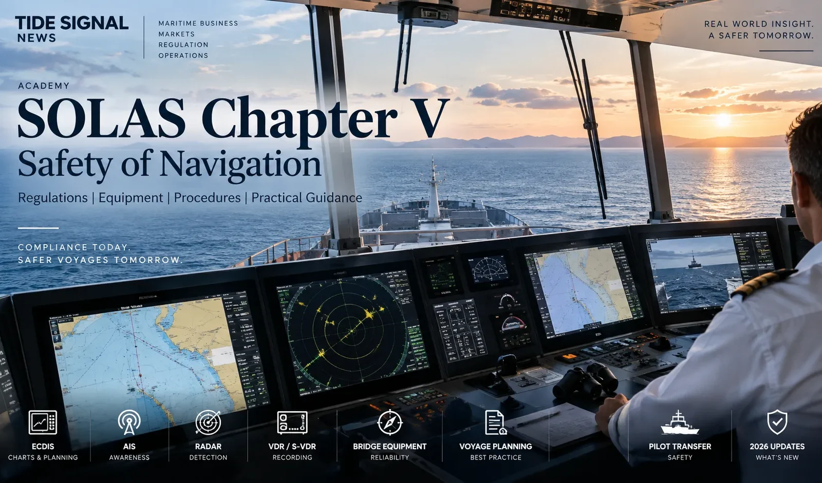
SOLAS Chapter V is the part of the Safety of Life at Sea Convention that turns “safe navigation” into a working shipboard system. It connects the bridge team with navigational equipment, charts, routeing, traffic services, voyage planning, steering arrangements, reporting obligations, pilot transfer, distress response and the master’s overriding responsibility for safe decisions.
It is also unusual within SOLAS because many of its operational provisions apply broadly to all ships on all voyages, subject to the specific application, exemption and equipment provisions of the chapter. That makes Chapter V relevant not only to large SOLAS cargo ships and passenger ships, but to the wider practice of navigation itself.
This guide is written for deck officers, masters, cadets, superintendents, ship managers, surveyors and maritime students. It explains the structure of the chapter, but more importantly it shows how the rules connect to everyday bridge operation. For the broader Convention architecture, start with Tide Signal’s SOLAS Convention guide.
What Is SOLAS Chapter V?
SOLAS Chapter V is titled Safety of navigation. The International Maritime Organization describes it as the chapter that establishes navigational safety services to be provided by Contracting Governments and operational provisions that apply, in general, to ships on all voyages.
That distinction matters. Much of SOLAS is built around defined categories of ships engaged on international voyages. Chapter V reaches further because collision avoidance, weather information, voyage planning, distress response and safe bridge practice are not risks that begin only when a vessel exceeds a particular tonnage.
The chapter therefore operates on two levels at the same time:
- Shore and government obligations — hydrographic services, navigational warnings, meteorological information, search and rescue services, routeing measures, vessel traffic services and aids to navigation.
- Shipboard obligations — equipment, bridge design, maintenance, charts, passage planning, steering procedures, pilot transfer, navigational records, danger reporting and distress response.
The result is a safety framework that begins long before an officer takes a watch. A safe passage depends on the quality of charts, warnings, weather services, traffic organization, bridge equipment, training, procedures and decisions. Chapter V joins those elements together.
SOLAS Chapter V Regulations at a Glance
| Regulation | Subject | Operational meaning |
|---|---|---|
| V/1–3 | Application, definitions, exemptions and equivalents | Establishes scope and how specified exceptions or equivalents may be handled. |
| V/4–9 | Warnings, weather, Ice Patrol, SAR, life-saving signals, hydrographic services | Builds the shore-side information and rescue environment used by ships. |
| V/10 | Ships’ routeing | Covers internationally adopted routeing systems, including mandatory systems where applicable. |
| V/11 | Ship reporting systems | Provides the framework for mandatory or recommended reporting systems. |
| V/12 | Vessel Traffic Services | Links ships with organized shore traffic services where established. |
| V/13–18 | Aids to navigation, manning, bridge design, maintenance, EMC, performance standards | Sets the supporting safety architecture for the bridge and its equipment. |
| V/19 | Carriage of navigational systems and equipment | One of the central equipment regulations in the chapter. |
| V/19-1 | LRIT | Long-range identification and tracking obligations. |
| V/20 | Voyage Data Recorders | Requires VDR/S-VDR carriage for applicable ships. |
| V/21 | International Code of Signals and IAMSAR Manual | Supports standardized signalling and search-and-rescue response. |
| V/22 | Navigation bridge visibility | Addresses the navigator’s field of view from the bridge. |
| V/23 | Pilot transfer arrangements | Sets requirements for safe transfer of pilots and other personnel. |
| V/24–26 | Heading/track control and steering gear | Controls transition to manual steering, operation, testing and drills. |
| V/27 | Nautical charts and publications | Requires the navigational information necessary for the intended voyage to be adequate and up to date. |
| V/28 | Navigational records and daily reporting | Requires records sufficient to reconstruct important navigational events. |
| V/29–35 | Life-saving signals, limitations, danger messages, distress, safe navigation, master’s discretion | Connects navigational practice to emergency communication and command responsibility. |
Why SOLAS Chapter V Matters on the Bridge
Bridge safety is often discussed as if it were mainly about equipment: radar, ECDIS, AIS, gyro, autopilot and alarms. Chapter V takes a wider view.
A modern bridge can contain excellent equipment and still be unsafe if the passage plan is weak, charts are not corrected, alarms are misunderstood, bridge visibility is compromised, the OOW is overloaded, pilot transfer arrangements are unsafe, the steering system has not been tested, or the master is pressured to continue a voyage that is no longer safe.
Chapter V therefore combines technology, information, people and command authority. That is why it should be read together with COLREG, STCW, the Safety Management System and the ship’s bridge procedures rather than as a standalone equipment checklist.
Regulation V/19: Navigational Systems and Equipment
SOLAS regulation V/19 is one of the most operationally important parts of the chapter. It contains carriage requirements for shipborne navigational systems and equipment, with requirements varying according to ship type, size, construction date and service.
The exact statutory equipment list for a vessel should always be checked against its applicable SOLAS requirements, Record of Equipment, flag instructions and survey documentation. The practical point is that the bridge is expected to maintain independent means to establish position, heading, movement, traffic and navigational risk.
| System / equipment | What it contributes | Key operational risk |
|---|---|---|
| Magnetic / gyro heading systems | Heading reference for steering, radar, ECDIS and bridge systems | Unrecognized error can contaminate several connected displays. |
| Radar / ARPA | Target detection, ranges, bearings, collision assessment and independent position cross-checking | Wrong tuning, clutter settings or overreliance on vectors. |
| ECDIS / charts | Route planning, position monitoring, safety contour and navigational information | Incorrect settings, outdated ENCs, poor route checks or unsafe alarm management. |
| AIS | Automatic exchange of identity, position and voyage-related information | Incorrect static data, wrong navigational status, missing transmissions or treating AIS as collision-avoidance truth. |
| GNSS / position sources | Electronic position, time and speed inputs | Jamming, spoofing, antenna faults or unnoticed sensor disagreement. |
| Echo sounder | Depth information | Wrong range/scale, transducer limitations or failure to compare depth with charted expectations. |
| Speed and distance measuring equipment | Ship movement data used by navigators and integrated systems | Sensor error or inappropriate source selection. |
| BNWAS | Monitors bridge activity and escalates alarms if the watchkeeper does not respond | Improper mode, disabled alarms or crew unfamiliarity. |
| VDR / S-VDR | Records bridge and ship data for casualty investigation | Recording faults, missing sensor feeds or overdue tests. |
| Electronic inclinometer | Determines, displays and records roll motion on applicable new containerships and bulk carriers | New 2026 carriage requirement may be missed during newbuilding or equipment verification. |
Radar: not a decorative backup
Radar remains one of the most valuable independent tools on the bridge because it does not rely on another vessel transmitting information. It provides range and bearing information that can be used for collision assessment, land fixing and cross-checking electronic position data.
But radar performance depends heavily on correct operation. Gain, sea clutter, rain clutter, pulse length, range scale, orientation, stabilization and target acquisition all affect what the officer sees. Tide Signal’s guide to X-band vs S-band radar explains why the two radar bands behave differently in rain, clutter and target detection.
A good bridge team does not ask whether AIS or radar is “better”. It understands what each sensor can and cannot prove.
ECDIS: chart carriage, planning and monitoring
Electronic Chart Display and Information Systems can satisfy the chart carriage requirement when the installation and backup arrangements meet the applicable SOLAS framework. IMO made ECDIS mandatory through a phased carriage regime under regulation V/19, depending on ship type, tonnage and construction date.
Operationally, ECDIS safety depends on much more than having a valid ENC permit. The officer needs to understand:
- the selected safety contour and safety depth;
- the quality and scale of available ENC data;
- route-check parameters and cross-track limits;
- temporary and preliminary information where relevant;
- sensor inputs and position source selection;
- alarm and indication management;
- backup arrangements;
- how to continue safely when a primary sensor or ECDIS function becomes unreliable.
A route that looks clean on the screen can still be unsafe if the safety settings are wrong. ECDIS reduces workload only when configuration, chart quality and bridge procedures are correct.
AIS: identification is not collision avoidance by itself
IMO requires AIS on all ships of 300 gross tonnage and above engaged on international voyages, cargo ships of 500 gross tonnage and above not engaged on international voyages, and passenger ships irrespective of size.
AIS automatically provides information such as identity and position to other ships and coastal authorities. It is extremely useful for situational awareness, but it is not a substitute for radar observation, visual lookout or COLREG decision-making.
AIS data can be incomplete, manually entered incorrectly, delayed, absent or intentionally manipulated. In regions affected by GNSS interference, an AIS position may also inherit a false position from a compromised navigation input. Tide Signal’s guide to GNSS spoofing and resilient navigation explains why bridge teams must compare independent sources rather than trust a single digital position.
VDES: the next step after AIS — but not yet a 2026 carriage rule
In May 2026, IMO’s Maritime Safety Committee adopted the framework for the VHF Data Exchange System (VDES) as an alternative to AIS under future SOLAS provisions. The new framework is expected to enter into force on 1 January 2028.
VDES expands data capacity and introduces capabilities designed to support more secure ship-to-ship and ship-to-shore exchange. It is important for operators to track, but it should not be presented as a current 2026 replacement requirement.
BNWAS: monitoring the watchkeeper, not navigating the ship
The Bridge Navigational Watch Alarm System is designed to monitor bridge activity and detect a situation in which the officer of the watch may be unable to perform watchkeeping duties. Its alarm sequence is intended first to alert the OOW and then escalate to other qualified personnel if there is no response.
BNWAS does not judge whether the ship is on the correct track. It does not detect a collision risk or grounding risk by itself. Its safety purpose is narrower: to reduce the chance that an incapacitated or non-responsive watchkeeper leaves the bridge effectively unattended.
VDR and S-VDR
Regulation V/20 establishes Voyage Data Recorder requirements for applicable ships. VDRs record selected bridge audio, navigation, alarm and ship data so investigators can reconstruct the circumstances leading to a casualty.
The operational value of a VDR is often invisible until something goes wrong. That makes routine verification important. A unit can appear powered while a microphone, radar feed, position input or other required data source is not being recorded correctly.
LRIT is not the same as AIS
Long-Range Identification and Tracking is regulated under SOLAS V/19-1. LRIT provides global identification and tracking information to entitled governments and search-and-rescue services through an international data architecture.
AIS is primarily a broadcast system used locally and regionally between ships and shore stations. LRIT is a secure long-range reporting architecture. Both involve ship identity and position, but their technical operation, recipients and regulatory purposes are different.
Regulation V/27: Charts and Nautical Publications Must Be Adequate and Up to Date
Safe navigation depends on the information used to build the voyage plan. Regulation V/27 requires the nautical charts and publications necessary for the intended voyage to be adequate and up to date.
Depending on the voyage and the ship’s approved arrangements, the navigational information set can include:
- ENCs or paper charts where applicable;
- sailing directions;
- lists of lights;
- tide tables;
- Notices to Mariners and chart corrections;
- routeing information;
- radio and reporting information;
- port and pilot information;
- applicable warnings and temporary navigational information.
“On board” is not the same as “ready for safe navigation”. A publication can exist in the library but still be outdated. An ENC can be installed but expired, unlicensed or displayed at an inappropriate scale. A chart correction workflow can fail quietly if nobody verifies the update status.
SOLAS Voyage Planning: Regulation V/34
Regulation V/34 requires the master, before proceeding to sea, to ensure that the intended voyage has been planned using appropriate charts and publications and taking into account IMO guidance.
The IMO Guidelines for Voyage Planning, resolution A.893(21), organize good planning around four familiar stages:
- Appraisal — collect all information relevant to the intended voyage.
- Planning — develop the detailed berth-to-berth route and navigational strategy.
- Execution — conduct the voyage while considering actual conditions, traffic, weather, vessel status and available personnel.
- Monitoring — continuously verify the ship’s progress against the plan and record necessary changes.
Appraisal
Appraisal is where weak passage plans often begin. The bridge team should not start by drawing waypoints. It should first understand the route.
Relevant information may include draught and UKC policy, weather and currents, traffic density, routeing systems, reporting schemes, pilot boarding positions, chart quality, navigational warnings, tidal windows, squat, no-go areas, machinery limitations, security restrictions, ice, available tugs, emergency anchorages and contingency options.
Planning
The planned track should be detailed enough that the OOW can understand not just where the ship intends to go, but how risk will be controlled along the route.
Depending on the ship and voyage, the plan can identify:
- courses and wheel-over positions;
- cross-track limits;
- safe speed considerations;
- minimum UKC and company margins;
- parallel indexes and radar clearing ranges;
- reporting points and VTS calls;
- pilot stations and tug arrangements;
- abort points and contingency anchorages;
- areas requiring hand steering or additional bridge personnel;
- high-risk sectors affected by traffic, restricted visibility or environmental constraints.
Execution
A passage plan is not a contract requiring the ship to follow a line regardless of reality. Weather changes. Traffic develops. Berths become unavailable. Equipment fails. Security conditions can deteriorate.
The master must decide whether the voyage can continue safely under the conditions that actually exist, not the conditions assumed when the route was first prepared.
Monitoring
IMO guidance requires the plan to remain available on the bridge and the ship’s progress to be closely and continuously monitored. Changes should be controlled and recorded.
That is the practical difference between “having a passage plan” and actually navigating by it.
Regulation V/34-1: The Master’s Professional Discretion
One of the most important lines in Chapter V is not about equipment at all.
Regulation V/34-1 protects the master’s authority to take or execute any decision which, in the master’s professional judgement, is necessary for safety of life at sea and protection of the marine environment. The owner, charterer, company or another person must not prevent or restrict that decision.
This matters commercially because ships operate under schedule pressure, charterparty obligations, berth windows, cargo commitments and customer expectations. None of those removes the master’s safety responsibility.
Ships’ Routeing, Reporting Systems and VTS
Regulation V/10 — Ships’ routeing
Routeing systems are designed to improve the safety and efficiency of navigation and, where relevant, protect the marine environment. They can include traffic separation schemes, two-way routes, recommended tracks, deep-water routes, precautionary areas and areas to be avoided.
When a routeing system has been made mandatory for a ship’s category or cargo, the vessel is expected to use it unless there are compelling reasons not to do so. Such reasons should be recorded.
Regulation V/11 — Ship reporting systems
Mandatory ship reporting systems can require vessels to provide specified information when entering or navigating defined areas. These systems support traffic management, emergency response and situational awareness.
Bridge teams should know in advance:
- whether a reporting system is mandatory;
- the reporting points or geographical limits;
- the information required;
- the communication channel or electronic method;
- what must be reported if conditions or voyage details change.
Regulation V/12 — Vessel Traffic Services
VTS can provide information, traffic organization and navigational assistance services according to the local system. A VTS call does not transfer command of the vessel ashore. The master and bridge team remain responsible for safe navigation.
This distinction matters during high workload. An instruction or recommendation from shore is another input to bridge decision-making, not a reason to stop maintaining lookout, collision assessment or position monitoring.
Regulations V/24–26: Autopilot, Manual Steering and Steering Gear
Modern ships may spend long periods on heading control or track control, but Chapter V requires the bridge team to retain the ability to establish manual control quickly when navigation becomes demanding.
Regulation V/24 addresses the use of heading and track control systems in high traffic density, restricted visibility and other hazardous situations. The changeover between automatic and manual steering is to be controlled by responsible bridge personnel, and manual steering is to be tested after prolonged automatic operation and before areas requiring special caution.
Regulation V/25 addresses operation of the steering gear in areas where navigation demands special caution. Regulation V/26 covers steering gear testing and drills. The familiar pre-departure steering test is therefore not merely a company checklist item; it is part of the international navigation-safety framework.
A meaningful steering check should confirm more than rudder movement on the bridge indicator. The crew needs confidence in control positions, alarms, communications, power units, emergency arrangements and the practical method of steering if the normal bridge control path is lost.
Regulation V/22: Navigation Bridge Visibility
A bridge must give the navigator a usable view of the sea surface, horizon and sectors relevant to safe ship handling within the applicable design criteria.
Visibility can be affected not only by ship design but also by cargo, deck equipment, cranes, containers and temporary obstructions. That turns bridge visibility into an operational issue as well as a design issue.
The basic principle is straightforward: electronic equipment supports the navigator; it does not justify designing or operating a ship in a way that removes the necessary visual field without meeting the applicable standards.
Regulation V/23: Pilot Transfer Arrangements
Pilot boarding is one of the highest-risk routine interfaces between ship and shore. The transfer may take place while both the ship and pilot boat are moving, often at night, in swell and with limited room for recovery if something goes wrong.
SOLAS V/23 therefore regulates pilot transfer arrangements. The requirements are supported by IMO recommendations and technical standards covering the ladder, securing, access to deck, lighting, combination arrangements and associated equipment.
In 2025, IMO adopted a major revision to regulation V/23 and new mandatory performance standards. These are expected to enter into force on 1 January 2028, with requirements covering design, manufacture, installation, inspection, stowage, maintenance, replacement and familiarization.
Distress, Danger Messages and the Duty to Assist
Chapter V is not limited to keeping one vessel safe. It also creates obligations between ships.
Regulation V/31 and V/32 — danger messages
Masters are required to communicate defined dangers to navigation. From 1 January 2026, Chapter V also contains mandatory reporting provisions for the loss and observation of freight containers at sea.
Where a ship loses freight containers, the master must report the incident without delay, to the fullest extent possible, to ships in the vicinity, the nearest coastal State and the flag State. The amended regulation V/32 specifies information to be reported, including time, ship identity, position and the number or estimated number of containers, with further cargo and drift information where available.
This is a navigation rule because a floating or semi-submerged container can become a hazard to other ships even after the original cargo incident is over.
Regulation V/33 — distress situations
The master of a ship at sea who is in a position to provide assistance after receiving information that persons are in distress is bound to proceed with all speed to their assistance, subject to the regulation’s provisions and the circumstances of the case.
This duty links directly with GMDSS and SOLAS Chapter IV. Chapter IV provides the radiocommunication architecture. Chapter V contains the navigational and command obligation to respond.
What Changed in SOLAS Chapter V in 2026?
Three changes are particularly important for a current Chapter V reference.
1. Electronic inclinometers on new containerships and bulk carriers
From 1 January 2026, containerships and bulk carriers of 3,000 gross tonnage and upwards constructed on or after that date must be fitted with an electronic inclinometer, or other means, to determine, display and record the ship’s roll motion.
The requirement was inserted into SOLAS V/19. It does not turn every general cargo ship carrying deck containers into a “containership” for this requirement; the SOLAS amendment includes definitions and application language that must be read carefully.
2. Mandatory lost-container reporting
Amendments to regulations V/31 and V/32 entered into force on 1 January 2026. They make reporting of freight containers lost overboard — and containers observed drifting at sea — part of the SOLAS danger-message framework.
For masters and operators, the practical requirement is to have a reporting process that can rapidly capture position, time, identity, estimated number of containers and cargo information while the ship is also dealing with the immediate operational consequences of the loss.
3. Expanded polar safety and voyage-planning requirements
From 1 January 2026, the Polar Code/SOLAS framework expands safety-of-navigation and voyage-planning requirements to certain categories of non-SOLAS ships operating in polar waters, including fishing vessels of 24 metres in length overall and above, pleasure yachts of 300 GT and above not engaged in trade, and cargo ships of 300 GT and above but below 500 GT.
This reflects a broader principle already visible in Chapter V: navigational risk does not disappear because a ship falls outside the normal SOLAS certification categories.
| Change | Effective date | What operators should do |
|---|---|---|
| Electronic inclinometer for applicable new containerships and bulk carriers ≥3,000 GT | 1 Jan 2026 | Confirm specification, installation, recording and certification during newbuilding/equipment review. |
| Freight-container loss / observation reporting under V/31–32 | 1 Jan 2026 | Update bridge and company reporting procedures; ensure required information can be assembled quickly. |
| Expanded polar navigation/voyage-planning scope for specified non-SOLAS ships | 1 Jan 2026 | Check applicability before polar operation and update voyage-planning procedures accordingly. |
What Is Coming Next: 2028 Navigation Changes
A good compliance article should separate rules already in force from rules that have been adopted for later entry into force.
VDES as an alternative to AIS
IMO adopted the VDES regulatory framework in 2026, with new regulations expected to enter into force on 1 January 2028. VDES is intended to expand data exchange and improve communication security, including authentication capabilities intended to reduce spoofing risk.
Revised pilot transfer arrangements
The revised SOLAS V/23 framework and mandatory pilot-transfer performance standards are also expected to take effect on 1 January 2028.
Shipowners with newbuildings, major modifications or replacement programmes should therefore watch these dates well before 2028. Compliance planning in shipping often begins at specification and procurement stage, not on the legal entry-into-force date.
Bridge Cyber Resilience Is Now Part of Navigation Resilience
Chapter V was not written as a cyber-security code, but modern navigation equipment is deeply interconnected. ECDIS receives position, heading and speed data. AIS depends on navigation inputs. Radar overlays may use heading and position. VDR records multiple networked sources. Remote service and chart-update workflows can create digital dependencies.
The bridge therefore needs a plan for situations in which data is available but cannot be trusted.
- GNSS positions jumping or slowly drifting away from radar/visual reality;
- AIS targets appearing in implausible locations;
- heading disagreement between gyro repeaters or integrated displays;
- ECDIS showing a valid-looking position from a compromised source;
- loss of chart updates or corrupted removable media;
- remote-support connections affecting bridge-system availability.
Tide Signal’s Maritime Cyber Security guide explains why resilient navigation requires the ability to detect bad data and continue operating safely using independent methods.
Port State Control: What Can Attract Attention?
Port State Control does not inspect “Chapter V” as one single item. The PSCO looks at the ship’s actual condition, documentation, equipment and crew familiarity.
Navigation-related areas that can justify closer examination include:
- defective or unreliable navigational equipment;
- charts or publications that are missing, expired or not properly updated;
- weak or incomplete passage planning;
- crew unfamiliarity with ECDIS, steering changeover or emergency arrangements;
- AIS static or voyage data that does not match the vessel’s actual condition;
- BNWAS, radar, gyro or alarm defects;
- VDR faults or missing evidence of required testing;
- unsafe pilot-transfer arrangements;
- inadequate records of steering tests or navigational activities;
- evidence that equipment failures have not been properly assessed, reported or controlled.
The strongest preparation is not a last-minute inspection checklist. It is a bridge system that is already operated correctly every day. Tide Signal’s Port State Control preparation guide covers the wider inspection process.
Practical SOLAS Chapter V Bridge Readiness Checklist
The following is a practical operational checklist, not a statutory replacement for the vessel’s approved procedures.
Before departure
- Confirm charts, ENCs and nautical publications for the intended voyage are valid and updated.
- Complete and verify the berth-to-berth passage plan.
- Review current weather, warnings, routeing measures, reporting schemes and security information.
- Check critical bridge equipment and record defects.
- Verify gyro/magnetic heading comparison and compass information required by ship procedures.
- Test steering gear in accordance with the applicable requirement and shipboard procedure.
- Confirm bridge-to-steering-gear communications and emergency steering arrangements.
- Verify AIS voyage data and navigational status.
- Check ECDIS route, safety settings, sensor inputs and backup arrangements.
- Verify radar performance and appropriate settings.
- Confirm BNWAS status as required.
- Review pilot boarding arrangements if a pilot transfer is planned.
During the voyage
- Continuously monitor progress against the passage plan.
- Cross-check position using independent methods whenever practicable.
- Compare radar, visual, depth, heading and electronic position information for consistency.
- Reassess speed and bridge manning when conditions change.
- Comply with routeing, reporting and VTS requirements.
- Do not allow AIS information to replace COLREG assessment.
- Investigate sensor disagreement instead of simply acknowledging alarms.
- Record significant navigational events and changes to the plan.
Before confined or high-risk navigation
- Increase bridge manning where necessary.
- Ensure a qualified helmsman is immediately available where conditions require it.
- Confirm manual steering readiness.
- Review abort points, anchorages, tug use and emergency options.
- Agree Master–Pilot information exchange and bridge roles.
- Confirm both radars and independent position methods are being used appropriately.
- Reduce non-essential bridge distractions.
Master, OOW and Company Responsibilities
The master
The master has overall responsibility for safe navigation and for ensuring the intended voyage is properly planned. Chapter V also protects the master’s professional discretion when safety or environmental protection requires a decision that may conflict with commercial preference.
The officer of the watch
The OOW turns the passage plan into continuous navigation. That means maintaining lookout, monitoring position, assessing collision risk, managing bridge systems, complying with reporting requirements and escalating early when conditions exceed the watchkeeper’s safe margin.
The company
The company must provide a ship that can comply in practice: maintained equipment, competent manning, valid charts and licences, procedures, technical support, training and a culture that does not punish necessary safety decisions.
A company cannot write “Master has overriding authority” in the SMS and then apply commercial pressure every time the master exercises it.
SOLAS Chapter V, COLREG and STCW: How They Fit Together
| Instrument | Main role | Bridge example |
|---|---|---|
| SOLAS Chapter V | Navigation safety services, equipment, planning, procedures and command responsibilities | ECDIS/AIS/VDR carriage, passage planning, pilot transfer, steering tests |
| COLREG | Rules for preventing collisions at sea | Lookout, safe speed, risk of collision, conduct of vessels |
| STCW | Competence, certification, training and watchkeeping standards | Who is qualified to keep the watch and how watchkeeping competence is maintained |
| ISM Code | Company safety-management framework | Procedures, reporting, maintenance, risk controls and responsibilities |
Safe navigation requires all four to work together. Equipment without competence is unsafe. Competence without maintained equipment is unsafe. A good passage plan without COLREG discipline is unsafe. And a good bridge team inside a company that discourages safety reporting is also unsafe.
Common Operational Failures
1. Treating ECDIS as an autopilot map
The display is only as reliable as its chart data, configuration and sensor inputs. Poor safety settings can make a dangerous route look acceptable.
2. Treating AIS as verified truth
AIS can help identify traffic, but target information may be wrong or incomplete. Collision avoidance still requires proper lookout and independent assessment.
3. Passage plans that end at the pilot station
IMO voyage-planning guidance is built around the intended voyage, not an arbitrary point where a pilot boards. The ship still needs a safe navigational plan through pilotage waters.
4. Alarms acknowledged without diagnosis
Acknowledging an alarm silences a sound. It does not remove the underlying condition.
5. Steering changeover known only by one person
A real steering failure is the wrong moment to discover that watchkeepers are unfamiliar with local control, communications or power-unit changeover.
6. Digital position accepted despite physical contradiction
If radar, depth, visual bearings and expected ship movement disagree with GNSS, the correct response is investigation and independent fixing — not blind confidence in the digital display.
7. Commercial pressure entering the navigation decision
A berth window or charter instruction can be operationally important, but it does not remove the master’s duty or discretion under Chapter V.
Frequently Asked Questions
What is SOLAS Chapter V?
SOLAS Chapter V is the Safety of Navigation chapter of the International Convention for the Safety of Life at Sea. It covers navigational services, routeing, reporting, bridge systems and equipment, AIS, ECDIS, LRIT, VDR, pilot transfer, steering, charts, voyage planning, danger messages and the master’s safety authority.
Does SOLAS Chapter V apply to all ships?
Chapter V applies more broadly than most SOLAS chapters and contains provisions applicable in general to all ships on all voyages, subject to its specific application, exemption and equipment provisions. Some detailed equipment requirements depend on ship type, size, construction date and voyage.
Which SOLAS regulation covers ECDIS?
ECDIS carriage requirements sit under SOLAS regulation V/19. IMO introduced a phased mandatory carriage regime by ship type, tonnage and construction date.
Which SOLAS regulation covers AIS?
AIS carriage is addressed under SOLAS V/19. IMO requires AIS on ships of 300 GT and above on international voyages, cargo ships of 500 GT and above not on international voyages, and passenger ships irrespective of size.
Which SOLAS regulation covers VDR?
Voyage Data Recorder requirements are contained in SOLAS V/20, with applicability depending on vessel category, size and construction date.
Is a passage plan mandatory under SOLAS?
Yes. Regulation V/34 requires the master to ensure the intended voyage is planned before proceeding to sea, using appropriate charts and publications and taking IMO voyage-planning guidance into account.
What is the difference between AIS and LRIT?
AIS broadcasts ship information primarily for ship-to-ship and ship-to-shore awareness. LRIT is a long-range global identification and tracking system that distributes information through an authorized data architecture to entitled governments and search-and-rescue services.
What changed in SOLAS Chapter V in 2026?
Key 2026 changes include electronic inclinometer requirements for new containerships and bulk carriers of 3,000 GT and above, mandatory reporting of lost or observed freight containers under regulations V/31 and V/32, and expanded polar safety-of-navigation and voyage-planning requirements for specified non-SOLAS ships.
Is VDES mandatory in 2026?
No. IMO adopted the VDES regulatory framework in 2026, but the new provisions are expected to enter into force on 1 January 2028.
When do the new pilot transfer requirements enter into force?
The major revision to SOLAS V/23 adopted in 2025 is expected to enter into force on 1 January 2028. Operators should still prepare early because newbuilding specifications and replacement programmes can precede the legal date by years.
Key Takeaways
- SOLAS Chapter V is the core international navigation-safety chapter.
- It applies unusually broadly and combines government-provided navigation services with shipboard operational duties.
- Regulation V/19 contains major bridge-equipment carriage requirements, including AIS and ECDIS provisions.
- V/20 covers VDR, V/19-1 covers LRIT, V/23 covers pilot transfer and V/24–26 cover steering-related operation and testing.
- V/27 requires adequate, up-to-date charts and publications.
- V/34 makes voyage planning a safety obligation, not an administrative exercise.
- V/34-1 protects the master’s professional discretion when safety requires action.
- From 1 January 2026, applicable new containerships and bulk carriers must carry electronic inclinometers.
- From 1 January 2026, freight-container losses and observations at sea are part of the mandatory danger-reporting framework.
- VDES and the major revised pilot-transfer framework are important future changes expected in 2028 — not current 2026 requirements.
Continue the Tide Signal SOLAS & Navigation Cluster
Build the wider picture with Tide Signal’s SOLAS Convention overview, SOLAS Chapter III life-saving appliances guide, GMDSS / SOLAS Chapter IV guide, X-band vs S-band radar guide, GNSS anti-spoofing guide and Maritime Cyber Security guide.
Official References
- IMO — International Convention for the Safety of Life at Sea (SOLAS), 1974
- IMO — Safety of Navigation
- IMO — Electronic Nautical Charts and ECDIS
- IMO — AIS Transponders
- IMO — Voyage Data Recorders
- IMO — Long-Range Identification and Tracking
- IMO — Pilotage and Pilot Transfer Arrangements
- IMO Resolution A.893(21) — Guidelines for Voyage Planning
- IMO — Shipping Rules in Force from 1 January 2026
- IMO — SOLAS Consolidated Edition 2024, January 2026 Supplement
- IMO — MSC 111 Highlights: VDES and 2026 Navigation Developments
Editorial verification: Tide Signal reviewed IMO material current to 21 September 2026. Always verify vessel-specific compliance against the latest consolidated instrument, flag-State instructions and the ship’s statutory documentation.